The purpose of this page is to give you a general overview of what the clouds above you are called, as I refer to them in this weather blog.
High Level Clouds:
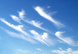 |
cirrus unicus: mares' tails
[stretching and moving of clouds means there will often be a change of wind direction on the ground] |
 |
cirrus fibrates
[high cirrus clouds with wispy patterns/fibers; wind shearing in the upper atmosphere denoting change of wind direction; sometimes get winter storms following these] |
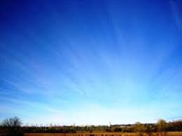 |
| cirrus radiatus |
 |
| cirrocumulus undulatus |
 |
| cirrostratus fibratus |
Middle Level Clouds:
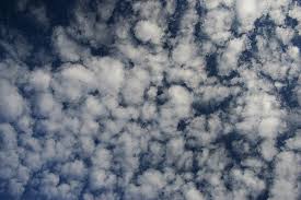 |
Altocumulus: mackerel sky
[wind shearing in the upper atmosphere; very likely there will be a change in wind direction at the surface]
Altocumulus are small mid-level layers or patches of clouds - called cloudlets - in the shape of rounded clumps. These are white or grey, and the sides away from the Sun are shaded. This shading helps you identify altocumulus clouds from cirrocumulus clouds that are only white. |
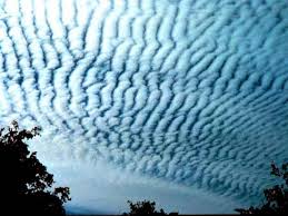 |
| altocumulus undulatus |
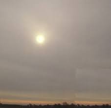 |
altostratus (one of the least photogenic clouds)
[Altostratus are large mid-level thin grey or blue colored clouds. Usually composed of a mixture of water droplets and ice crystals, they are thin enough in parts to allow you to see the sun weakly through the cloud. The sun cannot cast shadows when shining through altostratus clouds, which is how you can differentiate between altostratus and nimbostratus. They are spread over a large area - up to thousands of square miles - and they are either featureless or can have parallel stripes.] |
Stratus Clouds:
 |
| stratus undulatus |
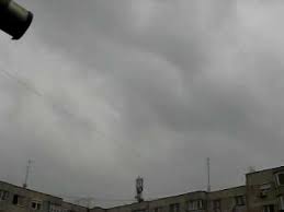 |
nimbostratus (another not very photogenic cloud type)
[Nimbostratus clouds are dark grey or bluish grey featureless layers of clouds, thick enough to block out the sun. These mid-level clouds are often accompanied by continuous heavy rain or snow and cover most of the sky. If there is hail, thunder or lightning it is a cumulonimbus cloud rather than nimbostratus.] |
Cumulous Clouds:
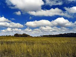 |
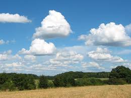
cumulus humilis
[longer horizontal axis than vertical axis; fair weather cumulus clouds; as temperatures increase, may get taller plumes as develop into not-so-fair-weather clouds] |
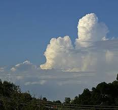 |
cumulus congestus
[These are the not-so-fair-weather clouds. A step must happen between fair weather humilis variety and congestus variety of cumulus clouds. That step in between is the cumulus mediocris.] |
 |
cumulus mediocris
[may turn into congestus clouds; they don't mean you will get a storm, but need to watch patterns to see if that's the next step] |
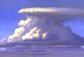 |
cumulonimbus
[anvil shape as hits tropopause since there is nowhere to go but outward (If the growth is too rapid, it may burst through the tropopause and have some cloud seepage into the stratosphere.); if weather gets super severe, you an get a cumulonimbus "super cell" that has its own rotation, as seen in tornado alley; cumulonimbus "wall clouds" denote a tornado forming] |
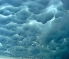 |
mammatus clouds
[indicator of severe weather (in tropics = storm; in Midwest = often brings tornados); pouches of moisture drooping down in bulges; if mammatus clouds are red or pea green in color, you are seeing rallay scatter and you are in for something big] |
No comments:
Post a Comment